

One of the more challenging tasks for scientists can be to parse the full range of effects born of large events. Sometimes it’s easy to pin an outcome to its cause. Last summer, for example, when temperatures soared to triple-digit highs for three days throughout the Pacific Northwest, attributing the widespread baking of intertidal life to this so-called heat dome was fairly straightforward.
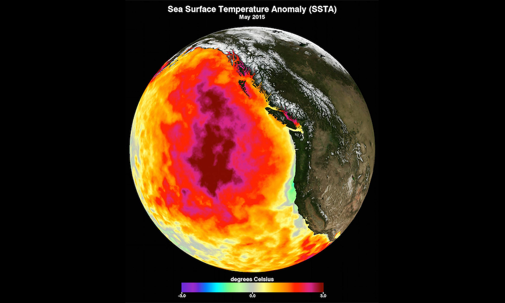
Sometimes, though, it is perhaps less straightforward. Take the marine heatwave now known colloquially as the blob. Beginning in the late fall of 2013, and persisting until 2016, a large patch of the northeast Pacific Ocean began to warm (or, more precisely, failed to cool). At its greatest extent, this warm patch encompassed millions of square miles of ocean, from Alaska and British Columbia south to California. Sea surface temperatures at their peak were almost 3 ºC above long-term averages.
At the time, the blob was the largest and longest-lasting marine heatwave in recorded history. (It would be displaced as the largest marine heatwave a few years later, in 2019.) In the years since it ended, many papers have come out exploring its impacts—physical, chemical, ecological—on the outer coast of North America. The known consequences for marine life in particular were spectacular and severe: tropical creatures showed up off the North American coast, marine birds and whales and sea lions starved and died by the thousands, and so on.
Not much had been written about the blob’s impacts on the Salish Sea, however. That hadn’t stopped people within the Salish Sea environment from speculating about the blob’s effects here. “People were blaming everything on higher water temperatures from the blob,” says Tarang Khangaonkar, the head of the Salish Sea Modeling Center at the University of Washington and a researcher with the Pacific Northwest National Laboratory. “I thought, How can you say that? It could have been a lot of things.” [Editor's note: The Salish Sea Modeling Center is housed at our affiliate organization the Center for Urban Waters.]
“Each of the blob years were marked by much higher-than-average river inputs,” Khangaonkar says. All that extra freshwater flowing out pulled more oceanwater in. So for extended period, a strong circulation regime was bringing in nutrients from the Pacific.
Khangaonkar had a way to test some of those speculations: the Salish Sea Model. As a representation of the interior marine ecosystem, the model’s digitized spaces stretch from the tip of Vancouver Island to central Oregon, and extend west out into the Pacific about to the edge of the continental shelf. But its main focus is the major waterways that make up the Salish Sea: the Strait of Juan de Fuca, the Strait of Georgia, and Puget Sound. “Over the years,” Khangaonkar says, “the model has grown to be a diagnostic tool that allows us to look at things we might not otherwise be able to test.”
What this meant for Khangaonkar and his colleagues at the University of Washington and the Washington Department of Ecology was that they could parse the blob and the Salish Sea into a suite of main effects, include those effects or remove them in turn, and see how the model responded. If it was able to reproduce observed conditions, they would perhaps have an idea of the physical mechanisms behind them.
