

The Salish Sea water boundary includes the Strait of Georgia, Desolation Sound, The Strait of Juan de Fuca, and Puget Sound. The larger watershed basin is the area that drains into the Salish Sea waters.
Maps and GIS
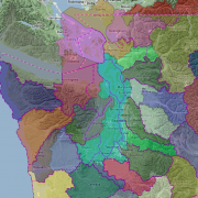
Interactive map of Puget Sound and the Salish Sea
GIS map layers on Pacific Northwest ERMA®
ERMA® is an online mapping tool that integrates both static and real-time data. Select the View Map button to see the map in a new browser tab.
Other GIS data resources
This list of Puget Sound area GIS data resources is adapted from the GIS data links published by the Washington State Department of Ecology.
Washington State
- Washington State Geospatial Portal
- Washington State Department of Agriculture
- Washington State Office of Financial Management - (360) 902-0555
- Washington State Department of Ecology
- Washington State Department of Natural Resources - DataServices@wadnr.gov
- Washington State Department of Health - (360) 236-4271
- Washington State Department of Recreation and Conservation
- Washington State Department of Revenue
- Washington State Department of Transportation
- Washington Geographic Information Council
- Washington State Geospatial Clearinghouse
- Washington State Redistricting Commission
- Washington State Historical Maps
- Official Washington State Highway Map
- Spatial Reference Center of Washington (archived; project no longer funded)
- Puget Sound Lidar Consortium
- Washington's Counties and Cities (links to)
British Columbia
U.S. Regional
- Pacific Northwest Hydrography Framework
- StreamNet - Fish Data for the Northwest
- Western Regional Climate Center
- Interior Columbia Basin Ecosystem Management Project
U.S. Federal
- Bureau of Land Management (BLM)
- Census Bureau
- Earth Resources Observation and Science (EROS) Center
- Environmental Protection Agency, Region 10 (EPA)
- Geospatial Data Gateway - USDA: NRCS
- U.S. Fish and Wildlife Service (National Wetland Inventory, NWI)
- Library of Congress
- National Park Service (NPS)
- Natural Resources Conservation Service - NRCS (soils)
- National Atlas of the United States
- National Map (USGS)
- United States Geological Survey (USGS)
University
Additional Resources
- How Puget Sound and Salish Sea boundaries are determined
- Puget Sound Recovery Atlas
- The Salmon and Steelhead Habitat Inventory and Assessment Project (SSHIAP)
- Historical GIS data for Puget Sound: Puget Sound River History Project
- Floristic Atlas of the San Juan Islands, Washington
- NetMap: Community Watershed Database and Analysis Tools
- NVS: NW Assoc of Networked Ocean Observing Systems (NANOOS)
- Pacific Northwest Environmental Response Management Application® (ERMA)
- PHS on the Web: Priority Habitats and Species (WDFW)
- Puget Sound Nearshore Ecosystem Restoration Project
- Salish Sea Seafloor & Habitat Maps (SeaDoc Society)
- Washington State Coastal Atlas
- Washington State Geospatial Data Archive (WAGDA)
Map Gallery
-

-

This map shows a GIS layer of all 60 shoreline habitat classes in Washington state. The map is symbolized based on marine/estuarine category and major substrate material. Marine shorelines are shown in cool colors; estuarine shorelines are shown in w
-

This map oulines the Puget Sound watershed area along with U.S. counties, cities, and urban areas. Published by the Puget Sound Partnership.
-
Water Resource Inventory Areas are Washington State management regions that do not strictly follow watershed boundaries.
-

This two-map series illustrates the impact levee vegetation maintenance requirements can have on salmon habitat.
More about ERMA®
Hundreds of GIS layers are freely available on NOAA's Pacific Northwest Environmental Response Management Application® (ERMA) mapping site, published by the NOAA Office of Response and Restoration. The Puget Sound Institute is collaborating with NOAA to add map layers and GIS data to Pacific Northwest ERMA®. The goal is to map Puget Sound and Salish Sea ecosystem data, analysis and research.
![]()
In ERMA®, you can search and visualize multiple map layers, view metadata, display attributes, query, zoom, print, and download GIS data. All in your web browser—with no additional software required. It's an effective tool for finding and browsing GIS information relevant to the Puget Sound region.
Related blog post
