Geography

We use geography to locate, organize, and describe places on the earth. This site focuses on the Puget Sound and broader Salish Sea regions of Washington state and British Columbia, which may be spatially mapped and subdivided using a variety of physical, political, or human factors.  The information on this site is generally limited to the Salish Sea waters and the surrounding land basin draining into those waters.

Overview

The boundaries of Puget Sound and the Salish Sea are not always consistently defined by scientists and government agencies. This article clarifies the distinctions between oceanographic and watershed-based definitions of these geographic areas. 

Water Resource Inventory Areas (WRIA). Map: Kris Symer. Data source: WAECY.

Related Articles

The Puget Sound Model was designed and built in the early 1950s at the University of Washington School of Oceanography as a research and teaching tool for understanding Puget Sound circulation patterns.

The Salish Sea extends across the U.S.-Canada border, and includes the combined waters of the Strait of Georgia, the Strait of Juan de Fuca, Puget Sound Basin and the San Juan Islands (see map).

The name Salish Sea was proposed by Bert Webber in 1989 to reflect the entire cross-border ecosystem. Both Washington State and British Columbia voted to officially recognize the name in late 2009. The name honors the Coast Salish people, who were the first to live in the region.

More information on the ecology and naming of the Salish Sea is available from the SeaDoc Society and Western

There are many ways of defining the boundaries of the Puget Sound watershed. Hydrologic unit codes (HUCs) are nationally standardized divisions that are often used by conservation agencies and national organizations.

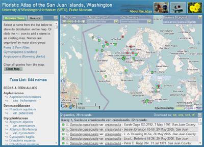
The Floristic Atlas of the San Juan Islands was created by the University of Washington Herbarium and provides a tool for mapping and comparing the distributions of vascular plant species within the San Juan Islands of Washington. 


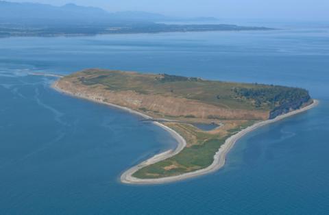
Protection Island, a National Wildlife Refuge in the Strait of Juan de Fuca, provides important habitat for seabirds and marine mammals.

Learn more about demographics in Whatcom County, Washington.  The U.S. Census Bureau published the following quick facts.