This article was originally published by the Washington Department of Fish and Wildlife as part of its annual report Threatened and Endangered Wildlife in Washington.
By Washington Department of Fish and Wildlife. Species accounts were compiled by Derek Stinson, Gary Wiles, Gerald Hayes, Jeff Lewis, Lisa Hallock, Steve Desimone, and Joe Buchanan.
This fall, elevated air temperatures, lower precipitation, and lower river flows generally persisted; this aligned with fall and winter climate predictions. Following a warm summer, October water temperatures dropped back to optimal ranges for many fish. Puget Sound water has cleared and visibility has increased as the productive season ends making it easier to document jellyfish and schools of fish in the inlets of South Sound. While these flights generate a lot of attention, the majority of our monitoring in Puget Sound is now done via boat!
There are many ways of defining the boundaries of the Puget Sound watershed. Hydrologic unit codes (HUCs) are nationally standardized divisions that are often used by conservation agencies and national organizations.
Lower than expected air temperatures and sunshine are now both increasing; rivers are generally running high. Willapa Bay unfolds its beauty from a bird’s-eye view. The spring phytoplankton bloom is picking up in Puget Sound. A large red-orange-brown bloom persists in southern Hood Canal at a scale sufficient for the MODIS satellite to pick up. Jellyfish are still going strong in southern inlets. Ocean climate indices (PDO, NPGO and Upwelling Index) explain much of the variability in Puget Sound temperature, salt and oxygen. Nutrients, however, are steadily increasing while sub-surface algal pigments (chlorophyll a) are declining!
The Lower Duwamish Waterway in Puget Sound was designated a Superfund cleanup site in 2001. Its legacy of contamination predates World War II and the waterway continues to pollute Puget Sound through stormwater runoff.
The Tulalip reservation is located near Marysville, Washington. It was created after the Point Elliott Treaty of 1855, and currently has a population of 2,500 members. The entire tribal population is approximately 4,000 and growing. Tulalip Tribes Area of Concern:The Snohomish River basin, part of the region where the Tulalip tribes focus restoration efforts, suffers from extensi...
As coastal and regional conditions gradually normalize in response to a fading Blob and increased rain, the big question remains. Will the snow in the mountains stay there or come down prematurely and lower salinity in Puget Sound like last winter? Cascade snowpack is currently below normal. The El Niño at the equator is still brewing! Major rivers transport large amounts of suspended sediments and soil into Puget Sound, also seen in our ferry sensor data. Our flight team gets in the pool for safety training.
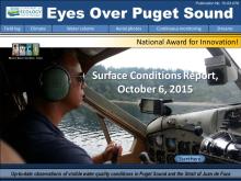
Puget Sound is starting to normalize in response to fall conditions with cooler air temperatures, rain, and recovering river flows. We are seeing fewer algal blooms, jellyfish, and macro-algae as salinities become more normal. Yet warm waters persist and El Nino and the Blob are likely to affect Puget Sound throughout the winter. The Nisqually River fared better through the drought than other rivers and best management practices have been improving its water quality. EOPS and ferry monitoring gain recognition with a national award for innovation!
This year, air temperatures were warmer than in previous years, and this pattern is predicted to continue. Precipitation was low and is now improving, yet river flows remain low. By August, Puget Sound surface water temperatures were 0.6 °C warmer across all regions; this could have shifted the timing of optimal temperatures for some marine organisms. In September, blooms are limited to inlets. Jellyfish are abundant in Sinclair Inlet, and anchovies reside in Eld Inlet. Macroalgae are still plentiful. Learn about the benefits of beach wrack and a DNA barcoding project supported by Ecology.