

All Articles

The watershed: A floristic atlas of the San Juan Islands
The Floristic Atlas of the San Juan Islands was created by the University of Washington Herbarium and provides a tool for mapping and comparing the distributions of vascular plant species within the San Juan Islands of Washington.
Well-being indicators in the Puget Sound Basin
A summary and categorization of types of social indicators and metrics used by government and non-government agencies in the Puget Sound Basin.

Eyes Over Puget Sound: Surface Conditions Report - October 8, 2012
Low to moderate fluorescence in northern Puget Sound. Red-brown blooms, and large jellyfish aggregations in the inlets of South and Central Sound. Dry weather and decreased thickness of the freshwater layer in Possession Sound.
Report: 2012 State of Our Watersheds
The State of Our Watersheds Report is produced by the treaty tribes of western Washington, and seeks to present a comprehensive view of 20 watersheds in the Puget Sound region and the major issues that are impacting habitat.

Protection Island
Protection Island, a National Wildlife Refuge in the Strait of Juan de Fuca, provides important habitat for seabirds and marine mammals.

Open Standards
Open Standards seek to build a common language and framework for decision making and prioritization of conservation issues.

Review finds minimal evidence for human impacts on Hood Canal hypoxia
An independent review conducted by the Puget Sound Institute (PSI) is featured in findings by the Environmental Protection Agency and the Washington State Department of Ecology that there is currently “no compelling evidence” that humans are the cause for recent trends in declines in dissolved oxygen in Hood Canal.
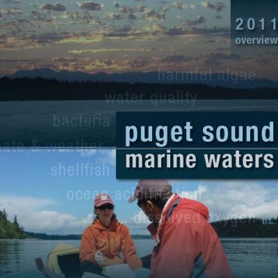
2011 Puget Sound Marine Waters Overview
The Puget Sound Marine Waters 2011 report is now available. The report was produced by the Puget Sound Ecosystem Monitoring Program and assesses the condition and quality of the waters of Puget Sound.
. Image courtesy of NOAA.")
Forage fish in Puget Sound
Forage fish occupy every marine and estuarine nearshore habitat in Washington, and much of the intertidal and shallow subtidal areas of the Puget Sound Basin are used by these species for spawning habitat.
Upper Skagit Tribe
The Upper Skagit tribe includes descendants from 11 villages in the Upper Skagit and Samish watersheds. Although the tribe signed the treaty of Point Elliott, no reservation was established, and members refused to leave the region. Today, the tribe's population is scattered among different towns, including Sedro-Woolley, Mount Vernon, and Newhalem.
Upper Skagit Area of Concern:
The Skagit River